Tuesday, December 02, 2008

PEOPLE AROUND UJUNG KULON NATIONAL PARK

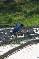
Local inhabitants around Ujung Kulon National Park are called Sundanese of the southwest Banten. 90% of the local people still live in the old tradition of relying on resources from land (farming, paddy fields) and sea (fishermen) for subsistence. Their staple rice diet is supplemented by corn, sweet potato, cassava, and various fruits such as bananas, and mangosteens. The villagers also raise water buffalo, goats, sheep, ducks, geese, chicken, and collect wild honey and palm sap.

In average, a village in this area consists of around 2,500 people, and a family usually consists of 4 members (Mother, father and two children). Most of the people finished elementary school, while some managed to get through junior high school. Only a few finished Senior high school. These communities are accessible through a bad road condition to the provincial road that eventually connects to the toll highway (around 250 km from the capital city Jakarta).

Each household usually has one or two sources of income (the father and the mother work) with average income ranging from IDR 390,525 to IDR 790,265 per month. Although many people work in the paddy fields, many of them also open an agriculture area in the forest. Part of the Park used to be a forest estate owned by Perhutani, a government owned mahogany plantation. Local people (workers) were allowed to cultivate vegetables, rice, and fruits in the estate. Later on, when the area was converted into a National Park, these people continued to maintain their farm inside the Park, and even further expand into the forest areas. It is clear that people residing near Park’s territory rely on forest resources for daily subsistence.

Thursday, November 27, 2008

LET'S BUILD A REEF!!!

Ever dreamed of having your own tropical coral reef?

© WWF-Indonesia
asd asd


BuildReef is an eco-tourism program designed by WWF project in Ujung Kulon National Park that can serve many purposes such as:
  • Enhancing ecosystem by placing human-made structure known as artificial reef. In many places, artificial reefs are recognized as a feasible means for enhancing marine ecosystem, increasing fishery potential, and improving tourism prospects.

  • Attaching soft coral colonies to the structures to attract fishes and other organisms to ensure that the coral reef recovery take place. Soft coral colonies are taken from people's farm to ensure that the wild coral population is not harmed for BuildReef activity

  • Improving tourism potential for the area, as tourism can bring potential income for local people

© WWF-Indonesia
In this program divers are invited to help install and stabilize the artificial reef structures called "racks". Racks are made of concrete with bamboo reinforcement embedded in the structure. One rack weighs approximately 100 kg to ensure fixation in BuildReef location. For this purpose, the racks have been pre-installed, but divers will be required to strengthen these racks further into the substrate (sand) in BuildReef area.


© WWF-Indonesia
The next step is choosing coral colonies to be attached to the racks. Coral colonies are attached to a mini substrate. This will ensure that the colonies are glued to the rack structures. Basket with coral colonies will be placed in a distance from the racks to prevent damage to the coral colonies during fixing and strengthening racks process. Divers will swim to the coral baskets, bring two colonies back to the racks and attach them to racks. It is recommended that diver bring only two colonies each time to prevent friction between colonies. Total of 24 racks and 600 coral colonies need to be installed in this trip. Throughout the process the water can get murky, but the dive master will oversee the activity and ensure the safety of all divers involved.

© WWF-Indonesia
After a while, the newly built reef will be ready for the visitation. BuildReef divers will be the ones to visit this reef, and observe the handy work they've done throughout the weekend. Furthermore, BuildReef divers will be asked to name this new reef. The coordinate location of this reef, along with the reef name will be recorded. A certificate will then be produced and sent out to BuildReef divers. This is not a certificate of ownership, but it will state that the individual is involved in the installment of the reef.

Sunday, February 25, 2007

How to Protect Coral Reef?


It’s easy!
Local people near Ujung Kulon National Park have initiated a community-based patrol around Badul Island in Banten province. The group puts aside a portion of income from tourism and aquaculture revenue for conducting patrol and protecting coral reef ecosystem around the island.

This community-based patrol scheme is, in fact, not a new thing in this part of the world. There are examples around Sebesi Island near Krakatau volcano and in Tanjung Jaya near Ujung Kulon National Park.

How can YOU protect a coral reef?

It’s even easier!
You can donate to support the group’s initiative; Thus improving their patrol capacity (contact
adhi-rsh@indo.net.id for details on this possibility). You can also join a BUILD REEF weekend in which you can actually build an artificially planted reef with live soft corals from local farm (please visit: www.javaseacharters.com for more details on this unique diving/tour package). Either way, you will give an enormous contribution to a coral reef ecosystem.

Saturday, December 23, 2006

Tips For Adventure Photography

Choosing Your Camera
It is now time to choose your camera to accompany you during your adventure trips. You can either bring a still camera and/or a video camera (handycam) to record exiting moments of your trips. Depending on your destination, certain types of camera will do a great job for you.
  • Mountain areas; characterized by high altitude, low temperature, and often high humidity (wet and misty). Make sure you have dry case, or, dry bag (or at least plastic bags) to protect your camera. Due to misty or cloudy conditions, please make sure that your camera can work under low light conditions. Manual cameras where you can adjust speed and diaphragm are ideal. However, some pocket cameras also have options for low light conditions (ie: night photos, candles, etc.).
  • Beach, oceans, and seas; open areas with plenty of light. Be cautious also with the humidity and splash. Seawater can harm electronic equipments. Choosing waterproof camera will be very useful and comfortable under this conditions. Dry case and dry bags are also useful, but they can be quite troublesome when you catch unexpected moments, and have to struggle to get your cameras out from the dry case/dry bag.
  • Forests; similar conditions with mountain areas. Some forest areas may be populated with vegetations that can damage your equipments (and your skin) such as thorns, hanging vines, dripping sap, etc. Please, watch out for these conditions by having proper protection for your equipments.

In most cases, pocket cameras are very good. They are light, small, and easy to operate. This is ideal in the places where you have to hike or walk a long distance, as they don't burdened you so much. Most digital pocket cameras can take great, high resolution pictures.

Monday, December 04, 2006

Halimun - The Misty Mountain


Citorek Village
The bitter cold greeted me in the morning. It was 6:30 am in Citorek village, West Java. This village lies near Halimun National Park, the last pristine mountain rainforest of West Java. I could not see farther than 3 meters as the mountain fog covered this beautiful landscape. It was too cold to take a bath without warm water this morning. Besides, due to the dry season, most of the wells in this village were already dried out. The name Citorek came from the word ‘Cai’ (Water/river) and ‘Torek’ (Deaf). Apparently back in the old days, the nearby river was so wide and the water was so deafeningly noisy that the people named the village after this phenomenon. Today, no such river existed.

The mountain trek that we were going to start from Citorek village was not like the regular trek I used to do. This one was going to go through mountainous areas, as well as sprawls of paddy fields along the way. Last night, we managed to ask local villagers to be our guides. Other than a few villagers, no one else had gone through this trek across the National Park. Ajo, Uwa (which literally means uncle) Nadim, and Nuhadi were the accompanying villagers. By 8:00 am, the fog gradually subsided, and we were all set to go westward to another village named Cibedug.

Megalithic Remnants
The trek was, as expected, quite strenuous with steep hill climbs and descents. Parts of it were covered with stones, but most were just bare red-orange soil known geologically as littosol soils. Some of us had to stop and breathe heavily adjusting to the pace of others and also to the heat from the sun that radiated the mountain and hill slopes. This morning it was really cold, but it became rather hot as soon as the sun came up.

Three-hour hike led us to a small village named Cibedug. Unlike Citorek, this village was isolated from the outside world, for no roads and cars could reach this village. We approached the house of a Kasepuhan elder. Kasepuhan is the highly respected elder councils in villages around Mount Halimun NP. There were influences of many Kasepuhan all over the villages in and around the National Park, including Cibedug village. After a short conversation with the elder, I decided to explore the megalithic remnants in this village known as Candi Cibedug (Cibedug temple).


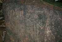
As a matter of fact, it was not a temple at all. The structure was a pyramid with platforms and other stone structures surrounding it. They were arranged in a certain way, as if accommodating some kind of ancient gathering of some sort. Interestingly there were also stone inscription nothing like Sanskrit or any other ancient scripts of Indonesia that I knew of. I was no anthropologist, but I would predict that these scripts predated the first kingdoms of Java.

The Baduy Tribe
We decided not to stay overnight in the village, but instead walked further west close to the point where we would start the southbound lag of the trip. Abah (Father) Nurja the village elder was kind enough to provide us with a villager to guide us in this trip. Again, we walked across paddy fields, rivers, and hills to a relatively flat area with a small hut by the paddy field. This place was also close to the river.


I erected my tent while other prepared the hut for an overnight stay. In the distance there were people dressed in white shirt with white Ikat (cloth band) in their heads. They were the members of the inner Baduy tribe. This was an ancient tribe still exist in the western part of Java. They refused to use modern tools such as vehicles, television, radio, even nails and paint for building houses. They rely on the materials available from their surroundings to build houses, farm agriculture commodities, as well as foraging fruits and vegetables. This time three of them, one Ayah (adult male), and three boys were carrying coconuts back to their village. This area of Mount Halimun Park was close to the villages of inner Baduy tribe. The Baduys have what was called the “restricted forest” where no hunting and foraging was allowed. In fact, this forest was off limits to most villagers.


The Southbound Trek
It was raining for half the night indicating the end of the dry season. Despite the rainfall, many of the paddy fields did not get water, as the water volume was not adequate to fill all the fields. However, it was enough to make our tracks slippery. Early morning, I forced myself to bathe in the river despite the cold water and air. It was surprisingly a refreshing way to start the day. After breakfast we packed all our belongings and logistics, we then started walking southward.

This route was long, as we walked along hilltops, slopes, and mountain range. No villages or civilizations existed in this area. Just forest and more forests, until we reached a river called the Cimerak (Peacock River). I did not know where the name came from, and neither did the villagers, as they never saw any peacock around. We made a camp on the river side for an overnight stay. In the night we exchanged information with the villagers about the Baduy tribe stories, the trips we had done previously, the animals we have seen, and also how the villages had been during the time of rebels in the 1960’s. One of the villages was Ciantalwangi that was abandoned in around 1956.

No rainfall in the night, just heavy fog in the morning. It was sunny, actually, but we needed to wait until the sun was up to be able to bask in its warmth. We did the morning bath ritual, to start the day. We continued south up the hill that was just behind our campsite. Heavy breathing came out of my chest and my colleagues’ as well. The villagers breathed normally, as they were used to exploring these mountains. We needed to take a break every once in a while, while the villagers were just chatted and laughed over the over-exhausted trekkers (my colleagues and I). We hoped to reach Cisiih, a village at the end of this long trek, today or tomorrow at the latest. It was hard with all the climbs, to which our guides referred as “easy” climb.

The rain started to fall again this afternoon, and we still needed to make our ways through the forest. We finally made it to the edge of a slash-and burn farm. There were still burnt out woods and roots where we stood. Not a good sign if you wanted to protect the forest, but a good sign of nearby civilization. Now the tricky part was to walk down the steep, deforested hill slope to reach the path below. Then it started to rain again, just enough to make this hill slope as slippery as an eel. Everyone made it in one piece, though. We stopped at a hut, as it was getting rainier. Fortunately for us, the hut owner offered brown palm sugar, a very nice snack for time like this. When the rain stopped we moved on to a dry paddy field to set up a camp. I just hoped that it wasn’t going to rain tonight, as the rain would surely flush down our campsite.

Civilizations
We were delighted to reach Cisiih after a long and hard trek. One of my colleagues was originally from this village, and he was still able to meet his great grandmother here. She was probably over 100 years old. She and her husband were some of the founders of this village, the civilization that we saw today. The discussion led us to the lost civilization in Ciantalwangi village. We heard the story that the communist rebels (PKI) and the Islamic rebel soldiers (DI) ransacked this village, and the people decided to abandon this area to find better and safer settlements. It would be interesting to see what that village looked like after 50 years. The team was then prepared to go to Ciantalwangi village for the next day.

After walking for almost half a day, the team reached a flat area in the forest of Halimun. We were not sure if this was the abandoned village, or just a different patch of forest. Later, the answer came in form of land depression from previous farming activities. Undoubtedly, this was the sign of past civilization, the abandoned village of Ciantalwangi.

The village was now a well covered secondary forest with remains of the village such as house foundation, farming marks, irrigation, and also village square scattered all over 20 hectares of forest. It was amazing to find past civilizations away from existing civilizations. Here in the misty mountain of Halimun is another treasure from Indonesian forest, a treasure of history.

Sunday, November 26, 2006

BALEO! a journey back in time


At the Beginning
I woke up early this morning in Kupang, East Nusatenggara. I had to do so, as I needed to get to the airport and to catch the (only) flight to Larantuka this week. The taxi moved along a winding road in a hilly area that we had to pass on the way to El Tari International Airport. El Tari airport was 15 km east of Kupang connected with a quiet road with only one or two vehicles passing by. This is, by far, a different scene compared to Jakarta International Airport.

Casa 212 plane was parked in the tarmac, while 19 passengers bound to Larantuka boarded amidst a light drizzle. It was a small plane, and there were no flight attendants. A crew member (probably a ground crew) handed out meal boxes as the passengers entered the plane. That was all the service we got for the whole flight. The two propellers of this tiny plane rotated steadily and pulled the plane down the runway. As the pilot gradually increased the throttle, the plane sped up and took off with a slight shake, rattle and just a touch of roll to align with the flight path. One and a half hours later I spotted a small town at the base of a volcano. That was Larantuka with the Ili Mandiri volcano standing magnificently in the background.

Port Of Larantuka
Larantuka is a town at the eastern part of Flores Island. Despite the isolation, this place attracted Portuguese traders searching for sandalwood and spices back in the 14th century. To accommodate this interest, they built forts and missions in this town. Today, in a much modernized day, Portuguese architecture in churches, chapels, as well as influences were still noticeable. Holy Mary chapel containing Portuguese bronze “ornamento”, statue of Mater Dolorosa, and Reinha Rosario were some of these influences. Furthermore, several traditional whale hunters still existed in the islands of Solor and Lembata around Larantuka. These people have performed the whale hunting ritual called the Leva long before Portuguese’s arrival.

There was an express ferry service connecting Larantuka and the nearby islands. The ferry was very comfortable with 200 seating capacity and 1.5 hours trip between Larantuka and Lewoleba (Lembata Island). For a quarter of the express ferry fare, people can also take the regular ferry, a wooden boat with 4 hours trip. The ferry left port of Larantuka and maneuvered between Adonara and Solor Islands heading for the first stop, a town called Waiwerang on the island of Adonara. Passengers disembarking here had to hop between wooden boats crowding the pier. It was a remarkable journey through waters around the islands with occasional views of smoking volcano. Arriving at Lewoleba pier on Lembata Island, bemos and motorcycle taxis (ojeks) offered their services to disembarking passengers. I took the bemo to get to Hotel Redjeki, one of the hotels in Lewoleba (the cleaner hotel compared to Hotel Lewoleba). I spent one night here, as the public transportation to the village of Lamalera only operated in the afternoon the next day.

The “Trans-Lembata Highway”
The public transportation to Lamalera village left Lewoleba terminal in the afternoon. It was a diesel truck (PS120) with the back converted for passengers by installing two long rows of sideway seats. A large speaker was hanging in the passenger room from which the pop and dangdut music blared. People seated next to the speaker had to cope with this for the whole 4-hour trip. I chose the seat as far away as possible from the speaker and managed to get the outermost seat. I thought this was the best seat, as it was far from the speaker, and it would provide me with better view. I was wrong, though. 50 meters from the terminal the truck had to pass a dry river with rocky beds, as the bridge above it collapsed a few months ago. After that, the road was winding and bumpy. A spent most of my time clinging to the railings behind me and on my side, as the road was bumpy and I was thrown off my seats several times. I remembered the “ejector seat” on fighter planes and felt that I was sitting on one. I suddenly thought that this was not the best seat after all, but all other seats were taken. It took a great skill to drive this big truck along this treacherous road. Meanwhile the fast-beat music roared from the speaker to accompany this ride along the “Trans-Lembata Highway”

4 shaky hours later I arrived at Mr. Abel Beding’s home stay, a clean accommodation that provided three meals a day for a reasonable price. The smell of something like dried fish was prominent in the village. It did not originate from a fish meat, but from slices of dried whale skin hanging in almost every home in Lamalera. They harpooned an 18-meter sperm whale last week. The story I heard in Larantuka a few days ago. Stacks of whale bones and skulls were also seen in many corners of this idyllic village. Apart from the whale-hunting tradition, Lamalera was a fishing village with strong catholic influences. Even their Leva ritual was now centered on a small chapel at the beach that happened to be the village’s central square.

The Hunters and Their Tools
There were three types of fishermen boat used in Lamalera: Layar, Johnson, and Paledangs. Layar were small canoes with sails that were used for fishing or catching
flying fish using nets. The Johnsons were wooden boats fitted with an outboard engine (Johnson brand) used for hunting dolphins/pilot whales. Paledangs were the traditional (and prestigious) whaling boats that were constructed according to the ancient model. These boats used rows as well as sail during a whale hunt. Nowadays, the Johnson boats were also used to tow these Paledangs when pursuing whales. Throughout the year, Paledang boats were stored in the huts. Only during Leva season from May 1st to September 30th that these boats were put to action.

Some people would constantly watch the water for signs of whales. When they’d seen the water spout from the whale’s blowhole, they would shout “BALEO!!” then the Paledangs and the Johnsons would scramble to the sea. Eight Paledangs were usually tied to one Johnson boat towing them close to the whales. About 10 to 5 meters from the whale, the tow ropes were released, and the Paledangs were on their own, rowing, chasing and harpooning the whales. A few years ago a Paledang harpooned a strong sperm whale that dragged them for 3 days (about 80 km) to the open sea. In the end the boat was destroyed, the crew was rescued, and the whale got away. Paledang boats had a special place in Lamalera tradition, as they were believed to link current generation with the ancestors. Loss of a Paledang boat would mean a great loss for villagers, and a specific ritual was necessary to “let go” the lost Paledang.

One unique thing about Paledang was that the fact the boat was built using neither steel, nor nails. All parts were tied up using ropes and the boat specs were defined by their ancestors. This was probably the reason why Paledangs were links to generations of whale hunters using technology developed centuries ago. Any deviation from the specification would result in disastrous consequences during whale hunt, as Paledangs should have high maneuverability and most would withstand attack of an angry whale.

The Soul of the Village
It was Saturday morning, and many women carried baskets on their heads. They were headed to village called Wulandoni for a barter market. Women from Lamalera brought dried fish and whale meat for exchange with other good (beans, corns, and fruits) at the market. Every Saturday women lined up on the beach waiting for their turn to board the Johnson boat that would take them to the market. Other took the passenger truck, while the rest walked. When they were not busy at the market, Lamalera women kept them occupied weaving beautiful ikat with whale, Paledang, or other motifs.

Other than sperm whales, other marine mammals were also abundant around Lamalera. Animals such as spinner dolphins (Stenella longirostris), Pilot whales (globicephala melas), and sometimes killer whales (Orcinus orca) were commonly sighted in the waters around the village. Two or three pods of these mammals often surrounded Lamalera fishermen at sea.

To most people, Lamalera was all about whale hunting. Baleo! At the sight of Koteklema (Sperm whale) followed by people pushing the Paledang and Johnsons boats to pursue the mighty giant, and the brave hunter who leaped on to the whale’s back using a harpoon to stab the whale at a lethal point. However, Lamalera was beyond all that. It was about people embracing their age-old custom, keeping tradition intact despite the modernization. It was about ancient technology kept alive without major modifications. Lamalera was a time machine that would take any visitor for a remarkable journey, a journey back in time.


Tuesday, October 31, 2006

Forgotten village at the edge of a World Heritage Site


On a densely populated and highly modernized island of Java, some people are still facing difficult and hard life. With small and no steady income to sustain their economy, people in Kampong Cegog must work very hard to make the ends meet. Kampong Cegog is located in the village of Rancapinang; sub-district Sumur, regency of Pandeglang, Banten. Nestled in a hilly area, it is the last settlement before entering the south part of Ujung Kulon National Park, a world heritage site, sanctuary of the last Javan rhinoceros.

Labuan, approximately 3-hour drive southwest from Jakarta, is the town where most people start their journey to Ujung Kulon National Park. Public transportations connect Labuan to villages near the Park, including Taman Jaya, the village where the mountain trek to Cegog awaits.


Mountain Trek
To reach Cegog, there is a trek across the Honje Mountain (approximately 400 m above sea level) from the village of Taman Jaya in the northwest. This trek starts from a relatively flat area of paddy fields and several small settlements. After around 45 minutes of easy walk there is a house for resting that marks the beginning of Honje Mountain. The owner of this house will welcome or politely offer travelers to stop by and have a drink. After a brief pause, the route continues across a small creek and into a denser vegetation of palm trees and rattans. This passage is about 1 meter wide with fallen leaves covering the forest floor and some roots. In the rainy season walking through this route becomes more fun with slippery, or ankle-deep mud, but luckily there are enough trees and hanging roots to hold on to, make sure to grab the ones without thorns, though. Although the sun is fiercely beating down on the landscape, the forest canopy provides enough cover along the way. Throughout the trek, there are some flat segments, but there are numerous steep uphill climbs. Getting used to this terrain, residents from settlements on either side of the Honje Mountain often use this route to travel between villages. Villagers carrying fish and other goods travel along this route to go to and from Cegog. Sometimes, travelers will have to yield or squeeze in order to let other travelers pass in a narrow passage. There is a point called “the tree of affection” where people must “affectionately” hug this tree when passing, for this large tree grow in a narrow hill with slippery floor and deep ravines on both sides. Afterwards there is a resting place by the river, stopping in this spot surrounded by lush green tropical vegetations with birds’ song after a long walk is truly a remarkable experience. A quick face-rinse with water from the river brings back a spark of previously fading spirit. After a long 6-hour walk and about 1.5 liters of drinking water, signs of civilization begin to emerge. Small shelters, sounds of children playing in a distant, and smoke from the kitchens mark the existence of Kampong Cegog settlements. It is the other side of Honje Mountain!

Kampong Life
This settlement is located between two major river streams, Surian river and Cegog river; hence the name Kampong Cegog. Currently, this settlement of approximately 900 people is relying on agriculture for daily subsistence.
Those who have farmland grow rice in their paddy fields, but those who don’t encroach the neighboring National Park, clearing parts of the forest for slash and burn agriculture. Most of these people do not have other options, as they sold their property to buy motorcycles and televisions. With motorcycles to maintain and no land to farm, these people find that household economy is definitely not getting any better. Fortunately, The National Park authority sets aside a stretch of coastal area as a traditional utilization zone where villagers can harvest natural-growing seaweed and sell it to local buyers. This provides Cegog villagers with an alternative way of generating income. Occasionally, Cegog villagers can sell cloves for a reasonable price. Only during that time, they receive good income.

Strangely enough, despite hard and difficult life they face in Cegog, almost all Cegog residents are reluctant to move out. In fact, many outsiders marry Cegog residents and decide to stay in Cegog for good.

Mr. Suganda is one of the residents originating from a village outside Cegog. He used to work for a resort on Peucang Island in Ujung Kulon National Park called Wanawisata Alam Hayati. He made a good living, that he was able to build a brick house and furnished it. Unfortunately, the company’s financial condition now necessitates many employees, including Mr. Suganda, to be laid off. Now, Mr. Suganda must rely on income from opening a small provision shop in front of his house besides farming. Luckily, he also owns a complete set of Video player with sound system. He, then, opens a home cinema where adults and children can view movies, music videos, etc. Entrance fee costs only Rp. 500,- per person.

Unlike Mr. Suganda, most Cegog residents do not own brick houses. Most of their houses are made of woods with woven bamboos as walls. Typical houses are stilt-houses built about 60 cm above the ground supported with several wood pilings. They install either wood planks, or flattened / split small bamboos for floors, and normally have clay tiles for roof. Village’s elementary school is not in a better condition. The walls of the school building came down, leaving only the roof standing. This is not a safe environment for school children, so they have to find other locations. Some good-willed residents offer and turn their porches into classroom where children can study with their teachers. Later on, the students decide to bring building materials and slowly, piece by piece rebuild their school.

Not everyone in Cegog owns in-house toilets and bathrooms. Open-air bathing facilities are available in the nearby rivers. Bathing areas upstream, washing downstream, and toilets further downstream. Distance and several big boulders separate men and women’s sections.

Difficult access is the main constraint for Cegog’s economy. Main access road connecting Cegog with nearby villages is made of loose gravels, stones, dirt roads, and several river crossings. To make life easier, these river crossings are equipped with so-called “bridges” constructed from coconut trunks laid together traversing the rivers. With some balancing skills, these coconut trunk bridges serve the purpose quite well. Unfortunately, there are some crevices between the trunks wide enough for motorcycle’s tire to get stuck in. Some river crossings do not even have anything at all. This road condition makes motorized travel using motorcycles or pick up trucks treacherous in the dry season, and almost impossible in the rainy season. For this reason, crops and other products have to be transported manually using “pikul” –a bamboo pole with loads at both ends carried on the shoulder- most of the time. Buyers purchase crops at a very low price from Cegog villagers, as they have to pay quite a bit for transporting products out of Cegog. With this small income, Cegog villagers will have to purchase goods from outside for a high price, for these goods were also transported to Cegog the same way.
From 6 O’clock In the evening, the noise from diesel-fueled generators is heard throughout the settlement. People pay certain fee for maintenance and fuel to operate these generators, as government’s electricity has not reached Kampong Cegog. Two years ago, these people used kerosene lanterns and solar panels in their houses. At 11 O’clock at night, these generators are shut down right after the home cinema finishes, then, it is peace and quiet once more.


The Surroundings
Despite difficult access, Kampong Cegog is worth visiting, as it is surrounded by rugged, yet beautiful terrain consisting of Honje mountain range, coastal forest and sandy beach. This remote place is virtually untouched by tourism (or any other) developments. Javan gibbons (Hylobates molloch) are the prima donna of the Honje mountain. These elusive primates with gray-furred body and dark face are mainly active in the morning, swinging from tree to tree. Nature lovers will also enjoy diverse vegetations of this typical lowland rainforest in the Honje Mountain. Difficult trek with several steep climbs rewards travelers with the sights of interesting plant species such as strangling fig (Ficus sp) and Kiara tree. Crystal clear rivers, occasional sightings of primates, and continuous birds’ singing contribute to the characteristic serenity of the tropical rain forest along the way.

West of Cegog is decorated with beautiful coastal landscape of rocky and sandy beaches. Coastal vegetation consisting of Butun (Barringtonia sp), Ketapang (Cattappa sp), and Pandanus trees accompany the long beach stretch. These coastal vegetations and several caves provide comfortable shelters in otherwise hot and exposed beaches. Rocky beaches retain water in tide pools. These hollow rocks are filled with seawater during high tide, and retains water in low tide. Some species of corals, along with seaweeds, are living in these tide pools, as water is always available. However, rocky beaches are often unfriendly to disoriented boats. Numerous fishing vessels met their demise in this stretch of hard rocky beach. After 3.5 km of rocky beach plus 4 km of sandy beach, another trek leading back to the village of Taman Jaya will take travelers through a less mountainous route with similar tropical forest cover.

Other than being the safe haven for the last 50 of endangered Javan rhinoceros, her exquisite natural beauty qualifies Ujung Kulon National Park to receive World Heritage inscription by UNESCO in 1992. Hard working people of kampong Cegog are living next to one of the world’s most valuable treasures: Nature, the essence of a living planet.


For travel to Cegog or Ujung Kulon National Park, contact KAGUM community eco-tourism. Village of Taman Jaya, Sub-district Sumur, Pandeglang Banten. Call KAGUM at 62 868 12113378 c/o Warca Dinata (kagum@hotmail.com)